- Archaeological News
-
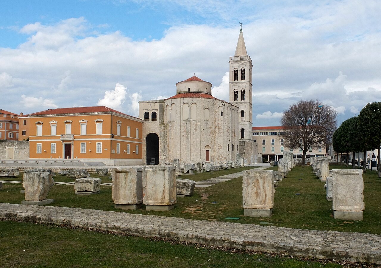
 Roman Forum in Zadar, reflecting the city’s long Roman heritage and historic urban landscape.
Image Credit:
Palauenc05, CC BY-SA 4.0, via Wikimedia Commons
Roman Forum in Zadar, reflecting the city’s long Roman heritage and historic urban landscape.
Image Credit:
Palauenc05, CC BY-SA 4.0, via Wikimedia Commons
Ancient Farmland Still Shapes the Modern City of Zadar
A new archaeological and historical study of Zadar, Croatia, shows that traces of the city’s agricultural past remain embedded in its modern urban landscape, despite rapid development during the 20th and 21st centuries.
The researchers describe these surviving features as green heritage: remnants of historic agricultural landscapes that continue to influence the appearance, structure and identity of the modern city. In Zadar, they include Roman land divisions, dry-stone field boundaries, surviving groves and gardens, and even modern streets that follow much older agricultural patterns.
Zadar is a roughly 3,000-year-old city on Croatia’s Adriatic coast. Its earliest settlement on the peninsula dates to the Liburnian Iron Age, before the city later developed into a Roman colony and continued through the medieval and early modern periods. For most of this long history, the city was surrounded by an agricultural landscape of vineyards, olive groves, grain fields and fruit trees. That relationship changed dramatically in the second half of the 20th century, when modern residential, commercial and industrial development expanded across areas that had remained agricultural for centuries or even millennia.
Yet much of the older landscape did not disappear completely. To reconstruct these changes, the researchers combined archaeological evidence with historical maps, aerial photographs, satellite imagery, cadastral records and modern city plans. In particular, they compared an Austrian cadastral map from 1826 with Royal Air Force aerial photographs taken in 1944 and the present-day urban landscape.
From this evidence, they identified four major forms of surviving green heritage. One of the most remarkable is Roman centuriation, a system used by Roman surveyors to divide agricultural land into regular plots. Around Zadar, traces of this ancient grid remain visible as long, regularly spaced boundaries approximately 710 metres apart.
The 1944 aerial photographs show this pattern particularly clearly. They reveal a large agricultural landscape crossed by an orthogonal Roman grid as well as a dense network of dry-stone walls.
Recent lidar research suggests that the centuriation system may have extended much farther than previously recognized, from areas northwest of Zadar toward the interior and southeast along the coast, while similar patterns have also been identified on nearby islands.
These ancient boundaries did more than divide property. Their continued use over centuries helped preserve older patterns of movement, agriculture and land ownership.
The second major form of green heritage consists of relict agricultural fields and dry-stone walls.
Historic aerial imagery shows extensive networks of stone boundaries around the city. Many were created as farmers cleared rocky land for cultivation, piling stones into walls and mounds. These structures also helped reduce surface runoff and soil erosion.
Some survive today as overgrown green spaces between modern neighbourhoods. They may contain collapsed stone walls, cairns, shrubs, pine trees and occasional olives or figs.
But these surviving areas are increasingly vulnerable. The study notes that many have already been transformed by new construction, especially residential development linked partly to Zadar’s strong tourism economy.
A third legacy appears in the structure of the modern city itself. When researchers compared present-day streets with the Roman centuriation grid and the agricultural boundaries shown on the 1826 cadastral map, they found that many modern roads still follow much older lines.
At least portions of 18 Roman centuriae correspond with the present street network, while other neighbourhoods preserve alignments inherited from historic farm roads and field boundaries.
In this sense, agricultural landscapes that have disappeared beneath houses and roads continue to shape how people move through the city today. The fourth form of heritage is still alive.
Olive groves, vineyards and gardens continue to survive within and around Zadar. Some modern olive groves occupy the same locations and follow similar spatial arrangements recorded on the 1826 cadastral map, showing continuity of land use over at least two centuries.
Household gardens also preserve elements of Zadar’s agricultural identity. The researchers recorded citrus fruits, grapes, olives, figs and a range of vegetables and herbs, including tomatoes, zucchini, peppers, beans, parsley and rosemary.
Several of these crops—particularly grapes, olives and figs—have been documented in the region since at least the Middle Ages.
The study argues that such features should be understood as cultural heritage just as much as historic buildings or monuments.
Ancient ruins and architecture are already central to Zadar’s identity, but the researchers suggest that agricultural landscapes also preserve evidence of the city’s long history and contribute to its distinctive sense of place.
Recognizing this green heritage could therefore have practical value for conservation and urban planning. It could help protect surviving agricultural spaces while contributing to biodiversity, urban greenery and environmental resilience.
The researchers conclude that Zadar provides a useful example for other Mediterranean cities, many of which expanded across historic agricultural landscapes during the modern era.
Rather than seeing urban development and agricultural heritage as entirely separate, the study suggests that the modern Mediterranean city can be understood as a layered landscape in which ancient fields, roads, walls, gardens and land divisions continue to influence urban life thousands of years later.
Published on: 29-08-2026
Edited by: Abdulmnam Samakie
Source: Antiquity